2022.05.09 MON
【Hiking • 016】
Sham Chung Grassland . Shui Long Wo – Star Lookout
深涌大草原 . 水浪窩觀星台
This trail offers a healing escape, taking you from historic Hakka structures to a hidden pastoral paradise. Starting from the Pak Sha O Youth Hostel, you’ll trek along a serene ancient path that leads to the sweeping Sham Chung Grassland, often dubbed 『Hong Kong’s Little New Zealand』. With its vast emerald fields and tranquil ponds, it’s the perfect spot to recharge at the Sham Chung Manor while soaking in the poetic, countryside vibes far from the city hustle. The route then hugs the coastline, offering a breezy stroll past Yung Shue O Village where you can enjoy panoramic views of the Kei Ling Ha Hoi mangroves and the rugged ridges of Ma On Shan. The journey concludes at Kei Ling Ha, where you’ll find the hidden Shui Long Wo Star Lookout. This unique, castle-like stone structure adds a touch of historical charm, providing a perfect finale to this scenic blend of nature and heritage.
Pak Sha O Youth Hostel → Sham Chung Manor → Sham Chung Grassland → Yung Shue O Village → Shui Long Wo – Star Lookout

Route Overview
Pak Sha O Youth Hostel → Sham Chung Manor → Sham Chung Grassland → Yung Shue O Village → Shui Long Wo – Star Lookout
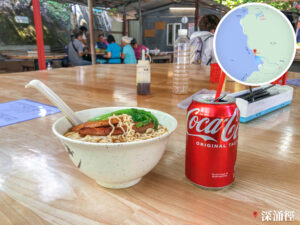
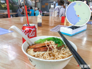
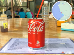
【Start】 Setting off from the Pak Sha O Youth Hostel, you’ll head along a trail that features some gentle ups and downs. The scenery here is stunning, surrounded by lush woodlands and crisp, fresh air. After about an hour’s hike, you’ll reach the Sham Chung Manor. It’s a perfect pit stop to grab some light refreshments and recharge your batteries.
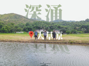
【Mid-Section】 Continuing on, you’ll find the Sham Chung Grassland right next to the manor. This spot is a famous local ecological hotspot, home to various butterfly species and rare dragonflies. The meadow feels boundless; during autumn and winter, the sight of silvergrass swaying in the breeze is truly spectacular. It’s also an ideal picnic spot where you can lay out a mat and soak in the peace and quiet of nature.
【Finish】 Leaving the grassland behind, follow the path which becomes relatively flat. You’ll enjoy views of coastal mangroves and the beautiful Sham Chung Wan before arriving at Yung Shue O Village. From there, keep going until you reach the Shui Long Wo – Star Lookout. This is a prime location for stargazing, offering a breathtaking view of the night sky framed by the distant mountain peaks.

Here are the reference statistics for this journey:

Route Breakdown
🚩
Start
《Pak Sha O Youth Hostel → Sham Chung》
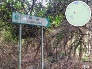
1. 📍 Start: Hoi Ha Road, Pak Sha O Youth Hostel》


Sham Chung / Lai Chi Chong / Ko Tong / Hoi Ha – Signpost
2. 📍 Sham Chung Trail 《I》

Pak Sha O, Pastoral Fields
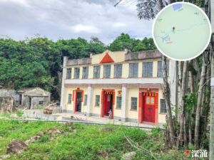
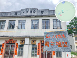
3. 📍 Ho’s Old Mansion

Ho’s Old Mansion
4. 📍 Sham Chung Trial 《II》

Hibiscus
5. 📍 Sham Chung Trial 《III》

No Cycling 🚫 🚴♀️ 🚘 – Signpost
6. 📍 Sham Chung Path 《IV》

Sham Chung / Pak Sha O / Lai Chi Chong – Signpost
7. 📍 Sham Chung Path 《V》

Sham Chung – Signpost
At the 2.3 km mark, you will reach a junction where you can alternatively head towards Lai Chi Chong (荔枝莊).
8. 📍 Sham Chung Path 《VI》

Shaded Woodland Path
9. 📍 Sham Chung School

Sham Chung School

Sham Chung, Village Houses
10. 📍 Sham Chung Trail 《VII》

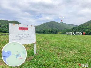
View of the Grassland

Yung Shue O / Pak Sha O – Signpost
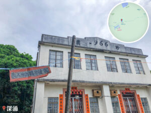
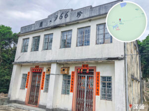
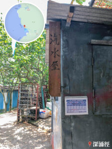
11. 📍 Sham Chung Manor, Entrance

Sham Chung Manor, Entrance
12. 📍 Sham Chung Trail 《VIII》

View of Shek Nga Tau

Alternate Path to the Manor
13. 📍 Sham Chung Trail 《IX》

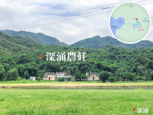
Sham Chung Grassland 《I》

Sham Chung • Grassland 《Panorama》
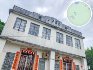
14. 📍 Sham Chung Manor

Sham Chung Manor
‼️ Note:
- The manor may have restricted access or adjusted business hours; please check local notices upon arrival
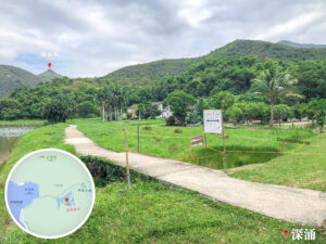
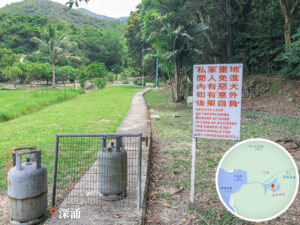
15. 📍 Sham Chung Grassland
Sham Chung Grassland 《II》
Route Breakdown
🏁
Finish
《Sham Chung → Yung Shue O → Shui Long Wo》
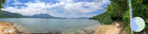
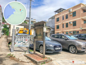
16. 📍 Sham Chung Wan

Sham Chung Village, Notice Board

Sham Chung Wan

Sham Chung Wan – Panorama
17. 📍 Sham Chung Pier

Sham Chung Pier

Yung Shue O / Sham Chung – Signpost
Sham Chung Pier – Information Board
18. 📍 Three Fathoms Cove (Kei Ling Ha Hoi) 《I》

Three Fathoms Cove, View of Ma On Shan / Ngau Ngak Shan
19. 📍 Three Fathoms Cove (Kei Ling Ha Hoi) 《II》

Peaks along Sai Sha Road 《I》
20. 📍 Three Fathoms Cove (Kei Ling Ha Hoi) 《III》

Peaks along Sai Sha Road 《II》
21. 📍 Loi Kee Store
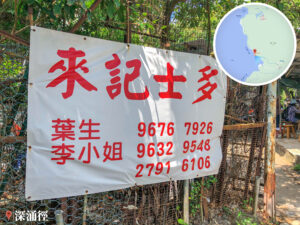
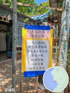
Loi Kee Store
22. 📍 Yung Shue O Village

Yung Shue O Village
23. 📍 Yung Shue O Village – Pavilion

Yung Shue O – Notice Board
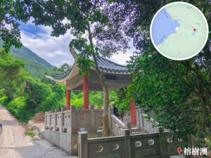

Yung Shue O Village – Pavilion
24. 📍 Yung Shue O Trail 《I》

Cheung Sheung • Country Trail 《Information Board》 (嶂上 • 郊遊徑 《地圖資訊板》)


Locobike 🚲
25. 📍 Yung Shue O Trail 《II》

Yung Shue O Trail 《II》
26. 📍 Yung Shue O Trail 《III》

View of the Peaks
27. 📍 Yung Shue O Trail 《IV》

View of the Peaks
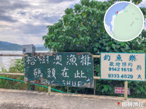

Yung Shue O – Fish Rafts
28. 📍 Yung Shue O Trail – Sai Sha Road

Yung Shue O Trail – Sai Sha Road

Signpost Cluster
29. 📍 Shui Long Wo

Shui Long Wo

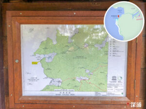
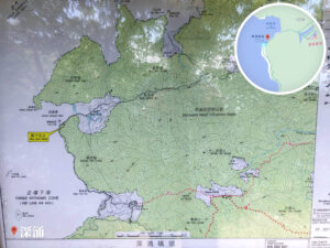
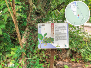
Kei Ling Ha Tree Walk
Here you’ll find the Kei Ling Ha Tree Walk – Information Map by the AFCD. It’s a good spot to brush up on some local geographical knowledge.

Shui Long Wo – Signpost
30. 📍 Kei Ling Ha Tree Walk – Signpost

Kei Ling Ha Tree Walk – Signpost
31. 📍 Shui Long Wo – Star Lookout

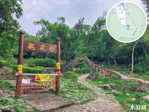
Shui Long Wo – Star Lookout, Entrance

Thelypteridaceae
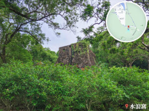
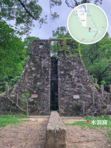
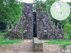
Shui Long Wo – Star Lookout
32. 📍 Finish: Shui Long Wo, Bus Stop
