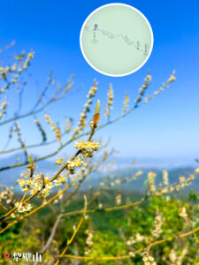
2023.01.28 SAT
【Hiking • 020】
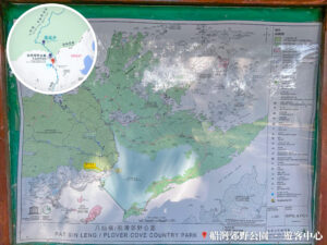
Pat Sin Leng . Wong Leng . Cloudy Hill
八仙嶺 . 黃嶺 . 九龍坑山
“This hiking route kicks off at the Tai Mei Tuk Bus Terminus, passing through the Pat Sin Leng Nature Trail, Pat Sin Leng, Lai Pek Shan, Wong Leng, Hok Tau Reservoir, Cloudy Hill, the Cloudy Hill Sky Stairs, and Yuk Sau Peak, finally wrapping up at Hong Lok Yuen and Tai Po Tau Road. It is a scenic yet demanding trail, perfect for seasoned hikers looking for a solid challenge. The entire route covers roughly 19.5 km and takes about 9 to 10 hours to complete. It’s best to tackle this during autumn to avoid the scorching summer heat and the biting winter wind.”
Tai Mei Tuk Bus Terminus → Pat Sin Leng Nature Trail → Pat Sin Leng → Lai Pek Shan → Wong Leng → Hok Tau Reservoir → Cloudy Hill → Cloudy Hill Sky Stairs → Yuk Sau Fung → Hong Lok Yuen → Tai Po Tau Road
Route Overview
Tai Mei Tuk Bus Terminus → Pat Sin Leng Nature Trail → Pat Sin Leng → Lai Pek Shan → Wong Leng → Hok Tau Reservoir → Cloudy Hill → Cloudy Hill Sky Stairs → Yuk Sau Fung → Hong Lok Yuen → Tai Po Tau Road
【Start】
Set off from the Tai Mei Tuk Bus Terminus and walk along Ting Kok Road for about ten minutes to reach the Plover Cove Country Park – Visitor Centre. From here, hop onto the Pat Sin Leng Nature Trail. This initial section is quite shaded, making it a perfect warm-up. You’ll find several info boards along the way introducing local natural phenomena and flora, so you can pick up some facts while soaking in the greenery.
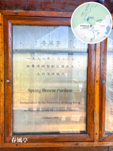
Keep heading up the nature trail until you cross the small bridge at Wang Chung Stream—it’s a great spot for a breather where you can enjoy the peaceful sound of running water. Continue further to reach Spring Breeze Pavilion, which commemorates the two teachers who heroically gave their lives during the 1996 Pat Sin Leng wildfire. The view here is incredibly open, offering a panoramic look at Ma On Shan and the Plover Cove Reservoir, making it a prime photo op.
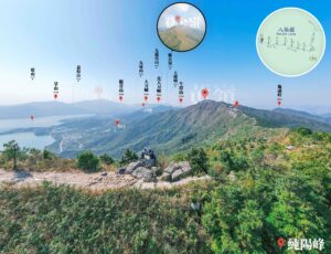
【Mid-section】 Moving on from the pavilion, you’ll hit the first peak of the 『Eight Immortals』—Hsien Ku Fung. There are quite a few stairs on this stretch, but the stunning views make the grind worth it. From there, you’ll traverse the ridge, passing through Tsao Kau Fung, Kwai Li Fung, Kao Lao Fung, and the rest of the eight peaks. While the distance between peaks isn’t huge, the terrain is quite rugged, so watch your footing. Once you reach the highest point, Shun Yeung Fung, take a moment to rest and enjoy the scenery. Descending from there leads you to Lai Pek Shan, another ideal spot for photos. Continue toward Wong Leng; though this part of the path is relatively flat, the ground is heavily weathered, so be extra careful with the loose trail conditions.
【Finish】
Next, head down the scree slopes toward Hok Tau Reservoir. This section is fairly steep and might require a bit of scrambling, but the vistas are spectacular. Once you hit the reservoir, it’s a good time to refuel and hydrate.
From the reservoir, follow the trail up toward Cloudy Hill until you reach the infamous Cloudy Hill Sky Stairs. This part is a real vertical challenge that tests your stamina, but the view from the summit is world-class. Heading down the 『stairs』, you’ll pass Yuk Sau Fung, which offers equally beautiful scenery. Finally, follow the path down toward Hong Lok Yuen to reach Tai Po Tau Road, marking the end of this epic hike.

Here are the reference statistics for this journey:
Transport Guide
START
MTR Tai Po Market Station
- Take Bus 75K or 275R (275R operates on Sundays and Public Holidays only) to the Tai Mei Tuk Bus Terminus.
Walk for about 10 minutes towards the direction of Bride’s Pool.


END
Tai Po – Tai Po Tau
- The finish line for this hike is at Tai Po Tau. You can walk along Tai Po Tau Drive towards Parc Versailles to catch the following buses back to the city centre or MTR stations; Bus Routes: 73, 64K, 65K, 74C, 74D, or the N73 (overnight).

Route Breakdown
🚩
Start
《Tai Mei Tuk → Pat Sin Leng → Wong Leng》
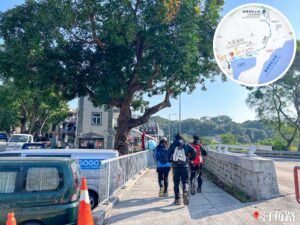
1. 📍 Start: Tai Mei Tuk Bus Terminus

Tai Mei Tuk Bus Terminus

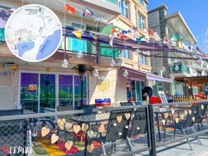
AQUA PEARL

Looking up at Pat Sin Leng

Lung Mei Village
2. 📍 Ting Kok Road 《I》
Ting Kok Road 《I》
3. 📍 Tai Mei Tuk Village
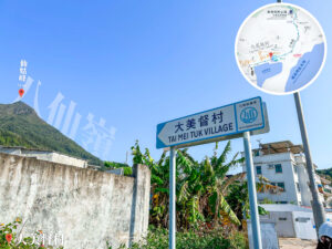


Tai Mei Tuk Village
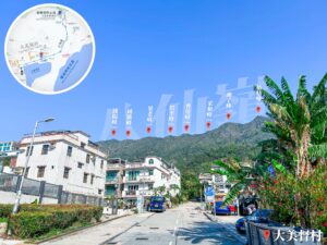
4. 📍 Ting Kok Road 《II》


Ting Kok Road 《II》
Reaching the end of Ting Kok Road, you’ll see the Plover Cove Country Park – Tai Mei Tuk Management Station ahead, framed by two of the peaks: Hsien Ku Fung and Sheung Tsz Fung.
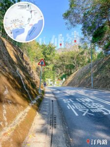
5. 📍 Intersection: Ting Kok Road / Mei Wu Road

Intersection: Ting Kok Road / Mei Wu Road 《I》
Gear Spotlight |🥾 Hoka One One Kaha GTX:
- As the saying goes, 『A journey of a thousand miles begins with a single step』. Choosing the right boots is key. This was my first pair of Hoka hiking shoes, and I definitely picked the right brand. They are incredibly comfy — you practically bounce uphill. They’re also waterproof, so rain isn’t an issue. Highly recommended!
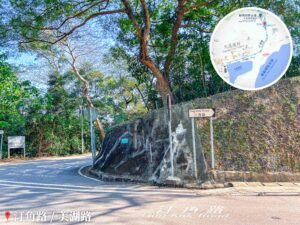
Intersection: Ting Kok Road / Mei Wu Road 《II / III》
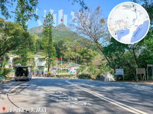
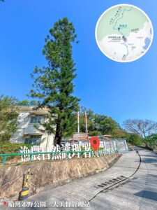
6. 📍 Plover Cove Country Park, Visitor Centre
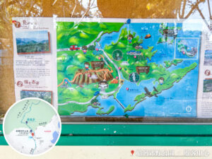


Plover Cove Country Park, Visitor Centre
Located near the end of the road, offering views of the upcoming climb towards Hsien Ku Fung.
7. 📍 Plover Cove Country Park – Tai Mei Tuk Management Station
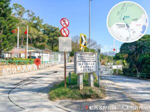

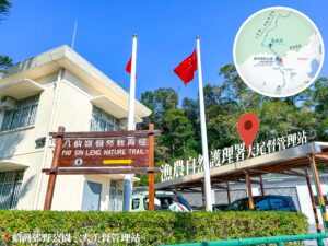
Plover Cove Country Park – Tai Mei Tuk Management Station
8. 📍 Pat Sin Leng Nature Trail 《I》

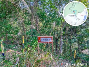

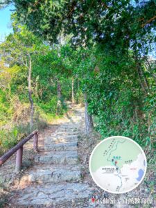


Pat Sin Leng Nature Trail 《I》
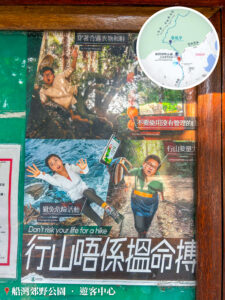
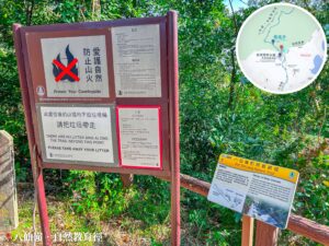
The Pat Sin Leng Nature Trail starts with a steady incline that can be a bit of a grind. Make sure to do some warm-up stretches at the foot of the hill. Remember: “Leave No Trace”—take your litter home, prevent wildfires, and protect our nature.
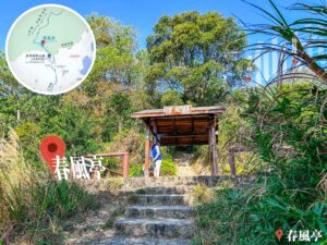
9. 📍 Pat Sin Leng, Spring Breeze Pavilion


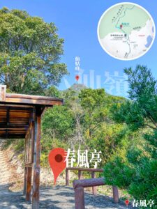
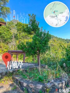
Pat Sin Leng – Spring Breeze Pavilion
The Spring Breeze Pavilion (春風亭) is located at the base of Hsien Ku Fung. It was built to honor two teachers, Mr. Chow Chi-kai and Ms. Wong Shiu-mei, who heroically sacrificed themselves to save students during the 1996 wildfire. The name symbolizes the 『nurturing breeze』 of selfless educators.
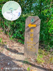
10. 📍 Pat Sin Leng Nature Trail 《II》

Ma Shi Chau – Info Board
Ma Shi Chau (馬屎洲) is one of the few places in HK where you can see Permian sedimentary rocks. You can find rocks formed 290 million years ago and volcanic tuff from the Jurassic period. It’s a geological wonderland with tombolos, quartz veins, and shell beaches.
11. 📍 Pat Sin Leng Nature Trail 《III》

Signpost: Bride’s Pool Road / Tai Mei Tuk / Wang Shan Keuk
12. 📍 Pat Sin Leng Nature Trail 《IV》

Plover Cove Reservoir at your feet

Nature Trail Info Board: Plover Cove Reservoir
13. 📍 Pat Sin Leng Nature Trail 《V》

Nature Trail Flora: Chinese Holly (枸骨)
14. 📍 Pat Sin Leng Nature Trail 《VI》

View of Tiu Tang Lung
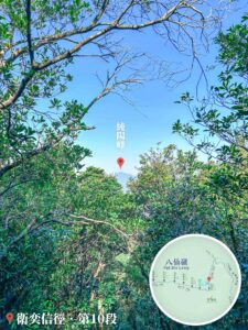
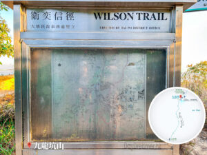
15. 📍 Wilson Trail – Section 10 《I》
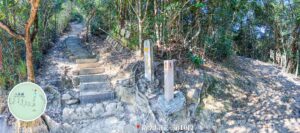
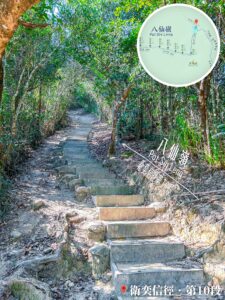

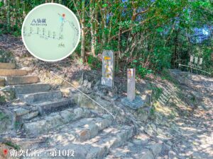
Wilson Trail – Section 10 《I》
16. 📍 Wilson Trail – Section 10 《II》

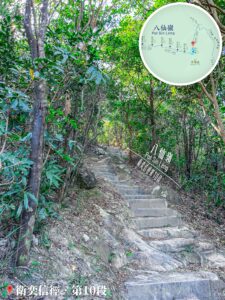
Step by Step
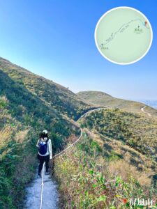
Brace yourself — the path leading up to Hsien Ku Fung is nothing but stone steps as far as the eye can see.
17. 📍 Wilson Trail – Section 10 《III》


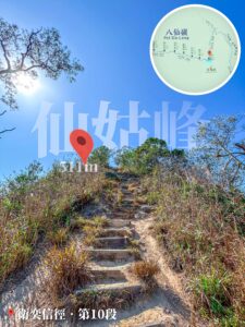


Hsien Ku Fung is within reach
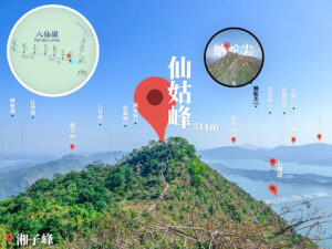
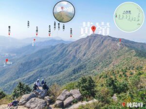
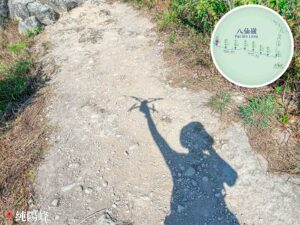
18. 📍 Hsien Ku Fung


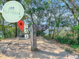

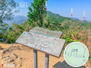
Hsien Ku Fung - The First Peak
19. 📍 Sheung Tsz Fung


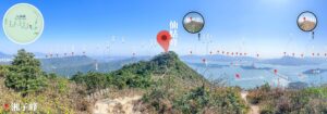


Sheung Tsz Fung - The Second Immortals
20. 📍 Tsao Wo Fung

Tsao Wo Fung
21. 📍 Tsao Kau Fung

Tsao Kau Fung
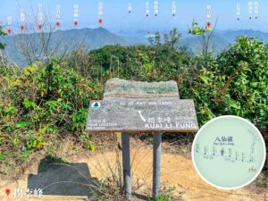
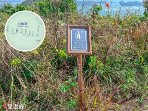
22. 📍 Kwai Li Fung

Kwai Li Fung
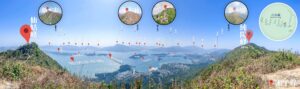
Keep going for another 100 meters past Tsao Kau Fung to reach the 5th peak, Kwai Li Fung (拐李峰).
23. 📍 Kao Lao Fung

Kao Lao Fung
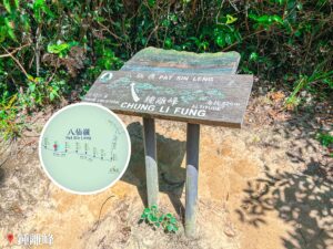
24. 📍 Chung Li Fung

Chung Li Fung
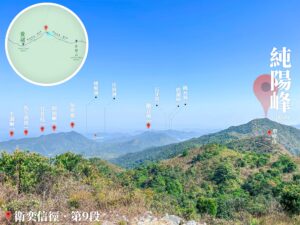
25. 📍 Shun Yeung Fung


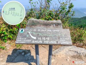
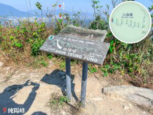
Shun Yeung Fung
26. 📍 Wilson Trail – Section 9 《I》

Looking down at Tsz Shan Monastery (慈山寺)
27. 📍 Wilson Trail – Section 9 《II》

Distance Post W123
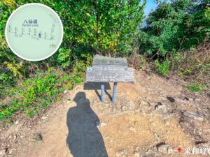
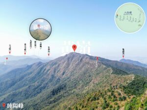
28. 📍 Lai Pek Shan


Lai Pek Shan
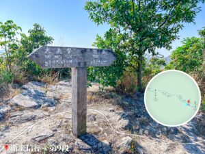
22. 📍 Wilson Trail – Section 9 《III》

Looking up at Wong Leng
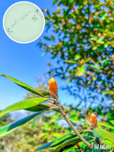
📸 Did you know?
- Bodinier’s Beautyberry (Callicarpa bodinieri) is a deciduous shrub about 2 meters tall. It has elliptical leaves with fine serrated edges and a grayish-brown underside. Both sides are densely covered with tiny dark red or red granular glands.
23. 📍 Wilson Trail – Section 9 《IV》

Distance Post W121
26. 📍 Wilson Trail – Section 9 《V》

Wong Leng is right there
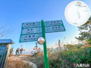
27. 📍 Wilson Trail – Section 9 《VI》

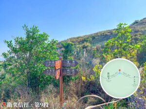
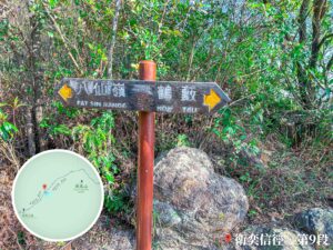
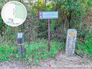
Wong Leng / Hok Tau / Pat Sin Leng / Tai Mei Tuk / Luk Keng / Nam Chung – Signpost 《II》
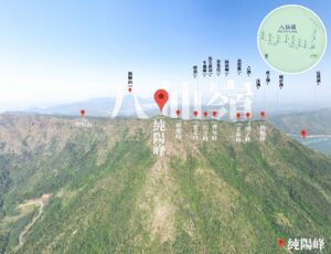
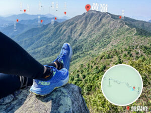
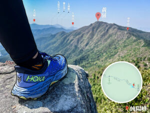
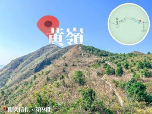
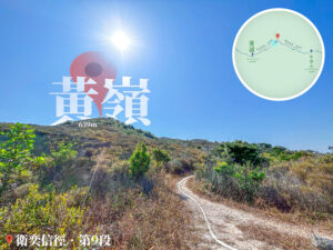
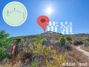
33. 📍 Wong Leng
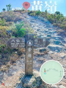

Wong Leng - The Highest Point
Route Breakdown
🏁
Finish
《Wong Leng → Cloudy Hill → Tai Po Tau》
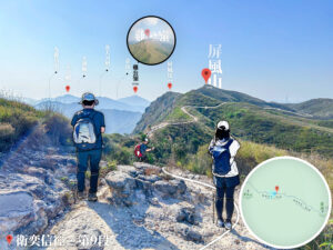
34. 📍 Wilson Trail – Section 9 《VII》


Overlooking Ping Fung Shan 《I》
35. 📍 Wilson Trail – Section 9 《VIII》

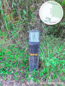
Distance Post W119
Grid Reference: KK 124 899.
36. 📍 Wilson Trail – Section 9 《IX》

Signpost: Pat Sin Leng / Hok Tau 《I》
37. 📍 Wilson Trail – Section 9 《X》

Overlooking Ping Fung Shan 《I》
38. 📍 Wilson Trail – Section 9 《XI》

Signpost: Pat Sin Leng / Hok Tau 《II》
39. 📍 Ping Fung Shan

Ping Fung Shan
40. 📍 Wilson Trail – Section 9 《XIII》

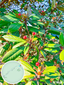
Flora: Litsea
41. 📍 Wilson Trail – Section 9 《XIII》

Overlooking the Ridge
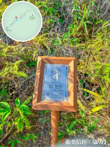
42. 📍 Wilson Trail – Section 9 《XIV》

Distance Post W114
43. 📍 Wilson Trail – Section 9 《XV》

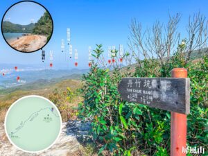
Signpost: Ping Tsz Shan / Pat Sin Leng / Hok Tau
The sign indicates that Hok Tau is 1.8 km away, estimated at about 30 minutes.
44. 📍 Wilson Trail – Section 9 《XVI》

Looking Back: Pak Yen Ngam / Tsing Shan Teng

『No Through Road』 • Sign
45. 📍 Hok Tau Reservoir Family Walk 《I》

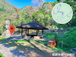
Hok Tau Reservoir Family Walk – Pavilion
46. 📍 Hok Tau Reservoir Family Walk 《II》

Reservoir Notice Board
47. 📍 Hok Tau Reservoir Family Walk 《III》

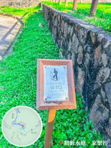
Distance Post W112
48. 📍 Hok Tau Reservoir – Dam


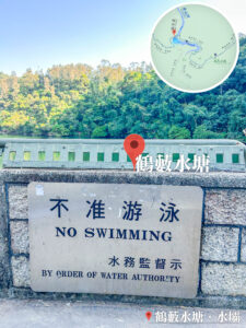
Hok Tau Reservoir – Dam
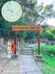
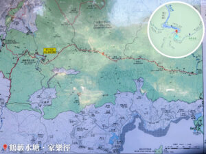
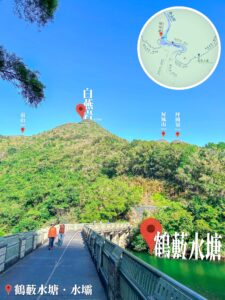
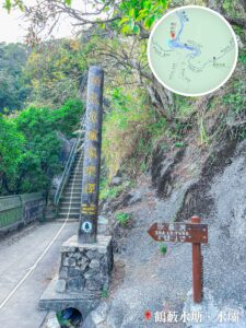
Located in the North District within Pat Sin Leng Country Park, the reservoir is named after the nearby village of Hok Tau Wai (鶴藪圍). Completed in 1968 for irrigation, it holds about 180,000 cubic meters and is shaped like a crescent moon. The 【Hok Tau Reservoir Family Walk circles the water (2.5 km, approx. 1 hour). It’s a great family spot with campsites, BBQ pits, and views of the Tan Shan River (丹山河).
49. 📍 Hok Tau Reservoir Family Walk 《IV》

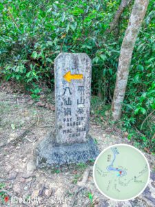
Signpost: Sha Lo Tung / Hok Tau / Cloudy Hill / Lau Shui Heung Reservoir
Leaving the reservoir behind, head towards Cloudy Hill. It’s a 2.8 km trek that takes about 1.5 hours.
50. 📍 Wilson Trail – Section 9 《XVIII》

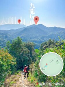
Looking Back at the Range: Wong Leng / Ping Fung Shan / Lai Pek Shan
As you climb towards Cloudy Hill, don’t forget to look back at the massive ridgeline you just conquered: Wong Leng, Ping Fung Shan, and Lai Pek Shan.
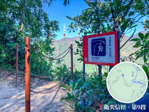
51. 📍 Wilson Trail – Section 9 《XIX》
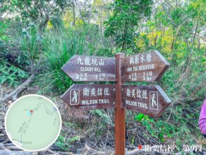
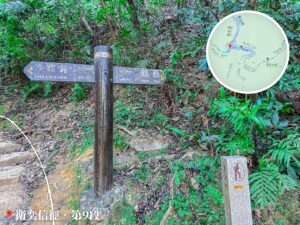
Signpost: Cloudy Hill / Wilson Trail / Hok Tau Reservoir
After passing Hok Tau Reservoir, continue heading towards Cloudy Hill. The signpost shows it’s about 2 km away, which should take roughly 1 hour.
52. 📍 Wilson Trail – Section 9 《XX》


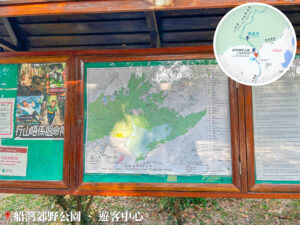
Wilson Trail – Section 9, Map Information Board
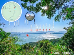
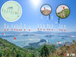
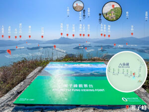
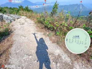
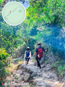
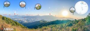
Wilson Trail – Section 9 is a serious challenge, spanning about 10.5 km and taking roughly 4.5 hours to finish. This section traditionally runs from Cloudy Hill to Hsien Ku Fung. The path hits several major highlights, including Hok Tau Reservoir, Ping Fung Shan, Wong Leng, and the eight main peaks of Pat Sin Leng. Each of these eight peaks is named after the 『Eight Immortals』 of Taoist lore: Shun Yeung, Chung Li, Kao Lao, Kwai Li, Tsao Kau, Tsao Wo, Sheung Tsz, and Hsien Ku. With significant elevation gains and losses, it’s a real test of stamina even with the paved sections.
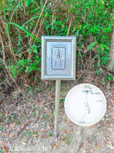
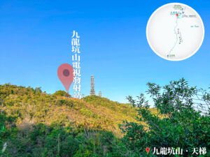
53. 📍 Cloudy Hill TV Transmission Station🗼
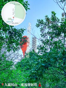
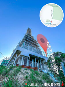
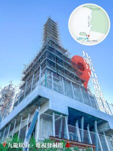
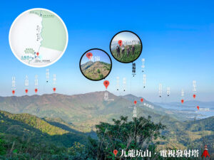

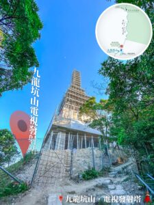
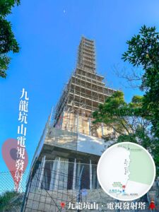
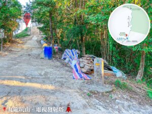
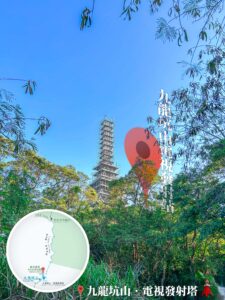
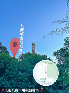
Cloudy Hill TV Transmission Station🗼
54. 📍 Junction of Wilson Trail – Sections 8 & 9
Stone Carved Signpost: Kau Lung Hang San Lo Wai / Lau Shui Heung Reservoir
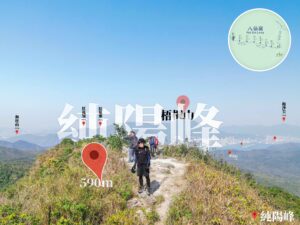
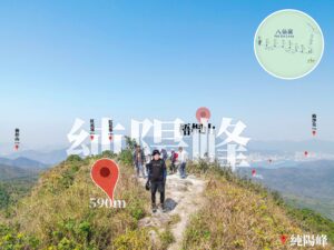
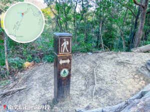
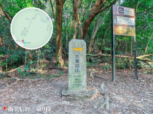
55. 📍 Cloudy Hill
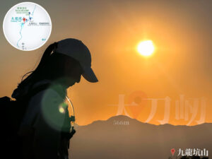

Cloudy Hill
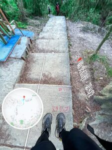
56. 📍 Cloudy Hill – Sky Stairs
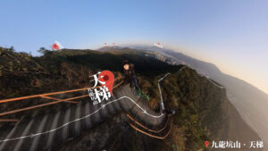

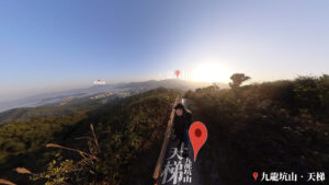
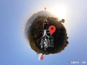
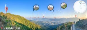
Cloudy Hill – Sky Stairs 《I》
57. 📍 Yuk Sau Fung
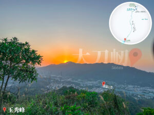


Yuk Sau Fung
58. 📍 Wilson Trail – Section 8 《I》

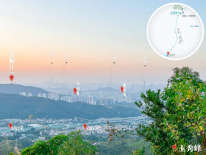
Yuk Sau Fung, View of Tai Mo Shan
59. 📍 Wilson Trail – Section 8 《II》


Wilson Trail – Section 8 《II》
Gear Spotlight |🥾 Hoka One One Kaha GTX:
- 『A journey of a thousand miles begins with a single step』. My first pair of Hoka boots really lived up to the hype — super comfy with a 『bouncy』 feel and great waterproofing for rainy days. Solid recommendation for this kind of distance!
60. 📍 Hong Lok Yuen

Hong Lok Yuen, Signpost for Tai Po Tau / Cloudy Hill
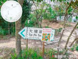
61. 📍 Tai Po Tau Drive

Tai Po Tau Drive – Signpost
62. 📍 Finish: Tai Po Tau Road