2021.05.19 WED
【Hiking • 015】
Fan Lau Fort . Kau Ling Chung . Tsin Yue Wan
分流 • 炮台 . 狗嶺涌 . 煎魚灣
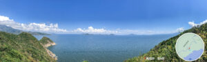
This hiking route is one of the most historic and scenic coastal sections of the Lantau Trail. Starting from the majestic Shek Pik Reservoir, the trail winds along the southwestern coastline of Lantau Island, leading you into a peaceful hidden gem far from the city bustle. The journey is packed with highlights: you’ll pass through the tranquil Kau Ling Chung and explore the centuries-old Fan Lau Fort ruins situated between Fan Lau Tung Wan (East Bay) and Fan Lau Sai Wan (West Bay), where you can witness the grandeur of an ancient coastal defense fortress. The most magical part of this trek is the bird’s-eye view of the 『Fan Lau』 phenomenon, where the muddy waters of the Pearl River Estuary meet the clear blue Pacific Ocean. After passing the pristine beach of Tsin Yue Wan, you’ll finally arrive at Tai O, the stilt-house fishing village famously known as the 『Venice of the East』. The entire route is approximately 16 km long. While the elevation gain isn’t too intense, it is a lengthy hike that takes about 5.5 to 6 hours to complete. It’s an immersive trail that perfectly blends natural landscapes, historical heritage, and fishing village culture—ideal for experienced hikers who love uncovering the stories of Hong Kong.
Shek Pik Reservoir → Kau Ling Chung → Fan Lau Tung Wan → Fan Lau Fort → Fan Lau Sai Wan → Tsin Yue Wan → Tai O

Route Overview
Shek Pik Reservoir → Kau Ling Chung → Fan Lau Tung Wan → Fan Lau Fort → Fan Lau Sai Wan → Tsin Yue Wan → Tai O
【Start】
Kick off from Shek Pik Reservoir and follow Section 8 of the Lantau Trail. This stretch is relatively flat, offering stunning views of the reservoir along the way. Keep heading forward until you pass the Tai Long Wan official campsite — it’s a solid spot to take a quick breather.
Next, follow the signs toward Kau Ling Chung. This is a beautiful beach with camping facilities, making it an ideal spot for an overnight stay. From the Kau Ling Chung Viewing Point, you can get a great bird’s-eye view of both Kau Ling Chung and Fan Lau Tung Wan.
【Middle Section】 Near the viewing point, there’s a small path leading down to Fan Lau Tung Wan. The scenery here is gorgeous, and you’ll spot natural landmarks like the Fan Lau Stalagmite. Once you hit the beach, continue toward the Fan Lau Fort. Built during the Qing Dynasty, this is one of the oldest forts in Hong Kong. It’s well-preserved and serves as a fantastic window into the city’s history. After exploring the ruins, keep going until you reach Fan Lau Sai Wan, a lovely beach where you can find local village stores to refuel and grab a drink.
【Finish】 From Fan Lau Sai Wan, head toward Tsin Yue Wan. This scenic beach also offers camping facilities and is a perfect spot for a final rest. The trail then leads you to Yi O, an eerie farm with a bit of a “post-apocalyptic” vibe, featuring several abandoned buildings. Finally, push through to Tai O. This iconic fishing village is full of local character, small boutiques, and seafood restaurants—making it the perfect finish line for your hike.

Here are the reference statistics for this journey:
Transport Guide
START
MTR Tung Chung Station
- Take 《Bus 11》 and get off at Sha Tsui Bus Stop.
- Alternatively, take 《Bus 23》 and get off at Sha Tsui Bus Stop.

END
Tai O Bus Terminus
- Take 《Bus 11》 for the return trip to Tung Chung.

📷 Tips:
- If you’re heading back on a weekend or public holiday, the queues for the 11 at Tai O can get pretty long. You might also consider taking the Ferry from Tai O back to Tung Chung or Tuen Mun for a more scenic (and breezy) way to end the day!
Route Breakdown
🚩
Start
《Shek Pik Reservoir → Kau Ling Chung》
1. 📍 Start: Shek Pik Reservoir – Sha Tsui Bus Stop

Shek Pik Reservoir – Sha Tsui Bus Stop

Lantau South Country Park – Wooden Sign

Lantau Trail – Section 9 (Shek Pik to Shui Hau), Map Board

What are Distance Posts?
2. 📍 Distance Post LX 323

Distance Post LX 323
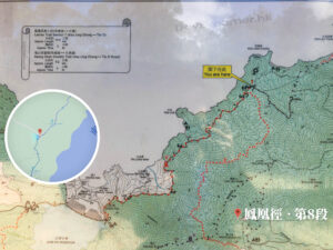
3. 📍 Lantau Trail – Section 8 《I》

Kau Ling Chung / Shek Pik – Signpost 《II》
4. 📍 Distance Post LX 324

Distance Post LX 324
5. 📍 Distance Post L085

Distance Post L085
6. 📍 Mountain Bike Trail: Pui O to Kau Ling Chung
Mountain Bike Trail: Pui O to Kau Ling Chung
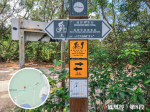
7. 📍 Lantau Trail – Section 8 《II》

Lantau Trail – Section 8 《II》
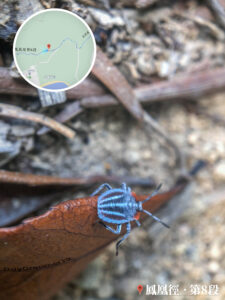
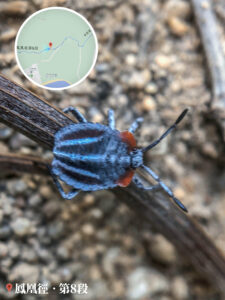
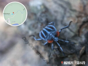
Keep an eye out for bugs!
8. 📍 Catchwater Area

Catchwater Area
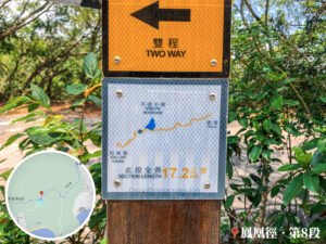
9. 📍 Lantau Trail – Section 8 《III》

Signpost for Shek Pik / Kau Ling Chung / Lung Tsai via Man Cheung Po
10. 📍 Lantau Trail – Section 8 《IV》

Lantau Trail – Section 8 《IV》
📷 Nearby Mountain Landmarks:
- Lantau Peak (鳳凰山) – Hong Kong’s second-highest peak.
- The Single Lifeline (一線生機)
- Kau Nga Ling (狗牙嶺)
- West Kau Nga Ling (西狗牙)
- Middle Kau Nga Ling (中狗牙)
- Roaring Tiger Rock River (虎吼石河)
11. 📍 Distance Post L 082

Distance Post L082
12. 📍 Lantau Trail – Section 8 《V》

Fan Lau Fort / Fan Lau, Stone Circle, Signpost
13. 📍 Distance Post L 081

Distance Post L081
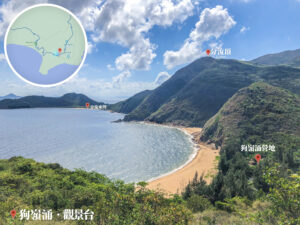
14. 📍 Tai Long Wan Campsite

Tai Long Wan Campsite
15. 📍 Distance Post L 079

Distance Post L 079
16. 📍 Lantau Trail – Section 8 《VI》

Lantau Trail – Section 8 《VI》

Pak Kok Path (白角徑)
📷 Other visible landmarks:
- Lantau Peak (鳳凰山)
- Kau Shan Teng (高山頂)
- Siu A Chau (小鴉洲)
- Tai A Chau (大鴉洲)
- Ngau Kok Wan (牛角灣)
- Guishan Island (桂山島)
17. 📍 Lantau Trail – Section 8 《VII》

Lantau Trail – Section 8 《VII》
18. 📍 Lantau Trail – Section 8 《VIII》
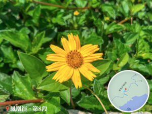

Roadside Wildflowers
19. 📍 Left Fang Washout No. 20

Left Fang Washout No. 20 《I》
Left Fang Washout No. 20 《II / III》
20. 📍 Distance Post L078

Distance Post L078
21. 📍 Distance Post L077

Distance Post L077

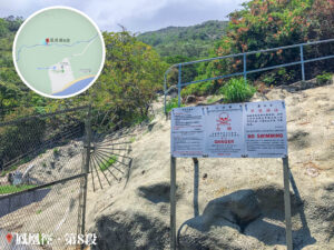
WSD – Danger Sign
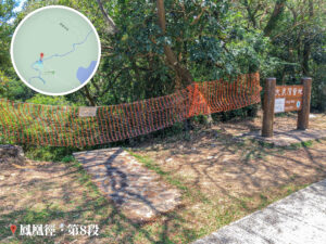
22. 📍 Kau Ling Chung Campsite, Entrance

Kau Ling Chung Campsite, Entrance

South Lantau Obelisk, Signpost
📷 Tips:
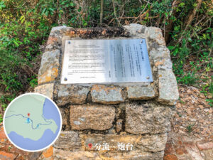
- In 1898, the Qing Dynasty and Great Britain signed the Convention for the Extension of Hong Kong Territory, leasing the New Territories (including Lantau) for 99 years. In 1902, British Navy Major Larymore arrived on the HMS Rambler to erect two granite obelisks—one in the north and one in the south. The South Lantau Obelisk is located at Kau Ling Chung, with the base engraved with the longitude 113°52’E, clearly marking the boundary of the leased territory.
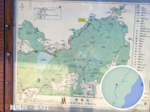
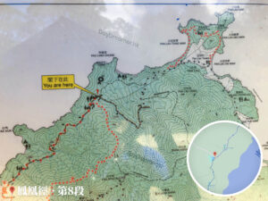
Lantau Trail – Section 8 (Kau Ling Chung to Shek Pik), Map Board
23. 📍 Distance Post L076

Distance Post L076
24. 📍 South Lantau Obelisk, Entrance

South Lantau Obelisk, Entrance 《I》
South Lantau Obelisk, Entrance 《II / III》
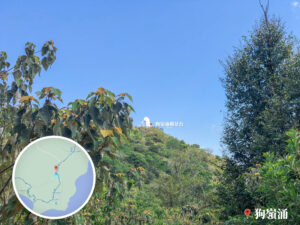
25. 📍 Kau Ling Chung Viewing Point, Entrance

Kau Ling Chung Viewing Point, Entrance
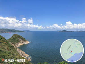
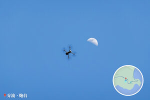
26. 📍 Kau Ling Chung Viewing Point

Kau Ling Chung Viewing Point – The Mysterious Soko Islands

Kau Ling Chung Viewing Point – Moonrise
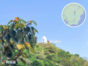
27. 📍 Kau Ling Chung
Kau Ling Chung
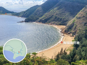
28. 📍 Kau Ling Chung Campsite

Kau Ling Chung Campsite, Beach

Kau Ling Chung Campsite, Bridge and Water

Kau Ling Chung Campsite, Campsite Notice Board

Kau Ling Chung Campsite, Wildflowers
Route Breakdown
🏁
Finish
《Kau Ling Chung → Fan Lau Fort → Tai O》
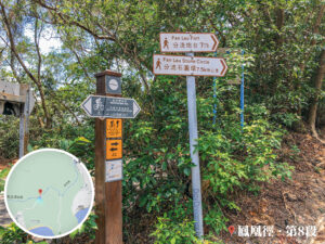
29. 📍 Lantau Trail – Section 8 《IX》

Fan Lau, Signpost 《I》
30. 📍 Lantau Trail – Section 7 《I》

Fan Lau, Signpost 《II》
31. 📍 Lantau Trail – Section 7 《II》

Fan Lau, Signpost 《III》

Fan Lau Country Trail, Signpost 《I》

Fan Lau Country Trail, Signpost 《II》
32. 📍 Fan Lau Country Trail 《I》
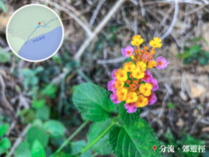
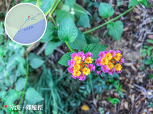
Fan Lau Country Trail – Wildflowers
33. 📍 Distance Post C1601

Distance Post C1601
34. 📍 Fan Lau Tung Wan (East Bay) 《I》

Fan Lau Tung Wan (East Bay) , Wide Bay
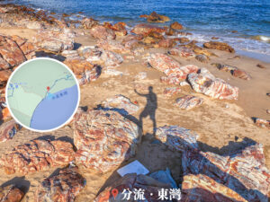
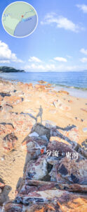
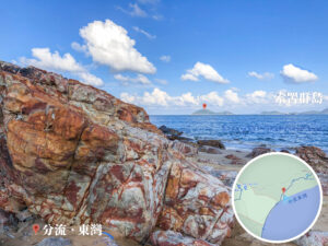
Fan Lau Tung Wan (East Bay) — 『fatty beef』 Rocks 🪨
35. 📍 Fan Lau Tung Wan 《II》

Fan Lau Tung Wan, Beach Buddies

Fan Lau Tung Wan, Beach Buddies
36. 📍 Fan Lau Tung Wan 《III》

Fan Lau Stalagmite, Distant View 《I》
37. 📍 Fan Lau Tung Wan 《IV》

Fan Lau Stalagmite, Distant View 《II》
38. 📍 Fan Lau Tung Wan 《V》

Fan Lau Tung Wan, Warning Board

Fan Lau Fort, Signpost 《I》
39. 📍 Fan Lau Stalagmite

Fan Lau Stalagmite
40. 📍 Distance Post C1602

Distance Post C1602
41. 📍 Fan Lau Fort
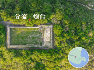
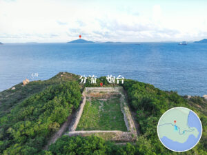
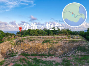
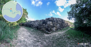
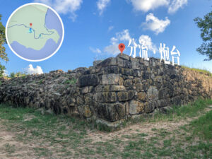
Fan Lau Fort

The Sky above Fan Lau Fort
42. 📍 Fan Lau Country Trail 《II》

Stone Circle, Signpost
Fan Lau Country Trail – Sunset
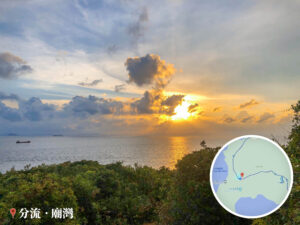
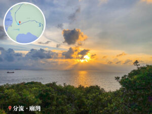
43. 📍 Fan Lau, Tin Hau Temple

Fan Lau, Tin Hau Temple

Fan Lau Miu Wan / Temple Bay
44. 📍 Fan Lau Sai Wan 《I》

Fan Lau Sai Wan, God Rays 《I》
45. 📍 Fan Lau Sai Wan 《I》

Fan Lau Sai Wan 《I》

Fan Lau Sai Wan, Beach
46. 📍 Fan Lau, Chan Kee Store

Fan Lau, Chan Kee Store
47. 📍 Fan Lau Village

Fan Lau Village, Signpost

Fan Lau – Info Map
的官方木製路牌")
Tsin Yue Wan, Signpost
48. 📍 Tsin Yue Wan

Tsin Yue Wan
49. 📍 Tsin Yue Wan Campsite

Tsin Yue Wan Campsite
50. 📍 Yi O Pier

Yi O Pier
51. 📍 Tai O, Fan Kwai Tong

Tai O, Fan Kwai Tong
53. 📍 Finish: Tai O Bus Terminus
