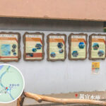
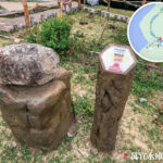
🥾 【MacLehose Trail – Section 1 (麥理浩徑第1段)】 is the eastern starting point of this famous 100-kilometer-long hiking trail. Beginning at Pak Tam Chung in Sai Kung, it stretches eastward along Sai Kung Man Yee Road, passing by the High Island Reservoir • West Dam and East Dam before finally arriving at Long Ke Wan. Spanning roughly 10.6 km, it usually takes about 3 hours to complete. This section consists mostly of flat, paved roads with very gentle climbs, making it widely considered one of the easiest stretches among the ten sections of the MacLehose Trail—absolutely perfect for hiking beginners and families. —
📌 Quick Info
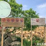
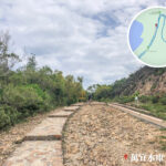
Item Details 🏞️ Country Park Sai Kung East Country Park 🗺️ Starting Point Pak Tam Chung, around 200 metres from Sheung Yiu Bus Stop 🏁 Ending Point Long Ke Wan, close to the start of MacLehose Trail • Section 2 🧭 Route Overview Pak Tam Chung → Man Yee Au → High Island Reservoir • West Dam → High Island (Leung Shuen Wan) → East Dam → Tuk Ku Shan → Long Ke Wan 📏 Distance Approx. 10.6 km 🧗♂️ Difficulty ⭐⭐☆☆☆ (Low to Moderate, beginner-friendly) 🛣️ Trail Conditions The first half follows a paved road, while the mid-section shifts into gravel trails and dirt paths. Marked with distance posts from M001 to M018 (Note: distance posts in later sections go beyond this, up to M048 near Section 2). 🏞️ Main Highlights 🌊 The bellmouth siphon spillway at West Dam 🪨 The anchor-shaped dolosse breakwater and hexagonal rock columns at East Dam 🌋 The viewpoint overlooking Po Pin Chau 🌋 Geological Wonders Hexagonal rock columns formed by volcanic eruptions 140 million years ago, part of the UNESCO Global Geopark. 📜 Historical Background Opened in 1979 and named after Hong Kong’s 25th Governor, Sir Murray MacLehose. The entire trail spans 100 km and is split into 10 sections. 🌟 International Acclaim Rated by National Geographic as one of the world’s 20 dream trails. 🧊 Things to Note Winds at the West Dam can get incredibly strong in winter—bring warm layers. The East Dam offers zero shade, making sun protection and water a must in summer. — In terms of transport, you can get to the starting point at Pak Tam Chung by catching bus 94 or green minibus 7 from Sai Kung Town Centre. It is important to note that the ending point at Long Ke Wan has no public transport at all. Hikers usually head back to the East Dam (which takes about 30 minutes) and call a taxi back to Sai Kung Town Centre (costing around HK$120 to HK$160), or opt to push forward onto Section 2. There are virtually no supply spots along the entire route, so be sure to pack enough food and water, and bring sun protection since there is very little shade along the way. —
🚍 Transport Info
🚌 Getting to the Start (Pak Tam Chung)
Bus Route Boarding Location Remarks 94 Sai Kung Town Centre Runs daily 96R Diamond Hill MTR Station Holidays only 289R Sha Tin Town Centre Weekends and public holidays only 698R Hong Kong Island East (Siu Sai Wan) Weekends and public holidays only Tip: Alight at the “Sheung Yiu” stop, and you’ll reach the starting point in just a 30-second walk.
🚗 Leaving from the End (Long Ke Wan)
- No public transport available. Your options are:
- Continue walking along Section 2 to the Sai Wan Pavilion, then take minibus 29R back to Sai Kung.
- Walk back to the East Dam and hail or call a taxi to Sai Kung Town Centre (approx. $120–$160, about a 30-minute ride).
— The route is brimming with breathtaking natural and cultural landscapes. As you walk, you can marvel at the High Island Reservoir—Hong Kong’s largest reservoir by storage capacity—whose waters glow with an enchanting turquoise-blue hue under the sun. The reservoir’s East Dam is a world-class geological landmark, showcasing arrays of hexagonal rock columns formed roughly 140 million years ago. These pillars are a vital piece of the Hong Kong UNESCO Global Geopark. Just outside the dam sits the massive concrete breakwater of anchor-shaped dolosse alongside Po Pin Chau, a famous sea stack islet formed by coastal erosion. Long Ke Wan, at the end of this section, boasts pristine white sands and crystal-clear waters. The stunning bay features a campsite right behind the beach, drawing crowds for camping and swimming. —
🗺️ Section-by-Section Breakdown (Pak Tam Chung → Long Ke Wan)
🔹 1. Pak Tam Chung → Man Yee Au (Approx. 1.5 km | ~45 mins)
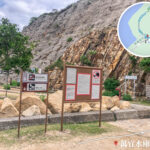
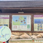
- The trail starts at the junction of Pak Tam Road and Tai Mong Tsai Road, marked by a large map board and signposts.
- Follow Tai Mong Tsai Road along a flat surface—perfect for warming up.
- Pass through the Man Yee Au roundabout to enter the High Island Reservoir area.
🔹 2. Man Yee Au → West Dam (Approx. 2 km | ~1 hour)
- Push ahead along Sai Kung Man Yee Road, where the turquoise waters of High Island Reservoir open up on your right.
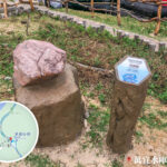
- Arrive at the West Dam, which features a viewing platform and a memorial monument, offering a prime vantage point of the reservoir.
- Look out in the distance to spot the sharp peak of Sharp Peak (Nam She Tsim) and the rolling ridges around High Island.
🔹 3. West Dam → Pak Lap Campsite (Approx. 1 km | ~30 mins)
- The road begins to undulate slightly here, with sweeping reservoir views accompanying you along the way.
- The Pak Lap Campsite is equipped with dry toilets and seasonal water sources—great for a brief break.
- You will hit the fork in the road leading down to Pak A and Pak Lap villages.
🔹 4. Pak Lap → East Dam (Approx. 2 km | ~1 hour)
- Continue winding along Sai Kung Man Yee Road, which is heavily exposed to the sun.
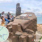
- Arrive at the East Dam, where the massive concrete anchor-shaped blocks stack high against the crashing waves.
🔹 5. East Dam → High Island Geo Trail (Approx. 1 km | ~30 mins)
- You can take a side path down to the High Island Geo Trail or a nearby trail to look out at Po Pin Chau, taking in the magnificent hexagonal columns and sea caves up close.
- As the core zone of the Hong Kong Geopark, its dramatic geological features make it an absolute paradise for photography and learning.
🔹 6. High Island Geo Trail → Long Ke Wan (Approx. 3 km | ~1 hour)
- The final stretch transitions into a natural dirt mountain trail with more noticeable climbs and drops, so watch your footing.
- Follow the hillside trail to catch a stunning panoramic view of Tsang Pang Kok Tsui cape and the entirety of Long Ke Wan.
- Drop down into Long Ke Wan to enjoy its soft white beach and clear waters. A designated campsite and dry toilets are available here.
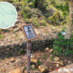
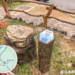
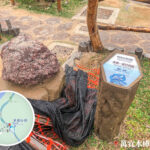
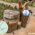
📍 Distance Post Reference
Distance Post Location Description M001 Starting point at Pak Tam Chung M007 High Island Reservoir • West Dam M018 East Dam area M048 End of Section 1 / Approach to Long Ke Wan 🧃 Pit Stops & Facilities At A Glance
Type Location Refreshment Kiosks Pak Tam Chung, Fat Kee Store near Sheung Yiu Toilets Pak Tam Chung, Yuen Ng Fan, Tai She Teng, East Dam Exit Routes Walk back from Tuk Ku Shan or take a side trail from Luk Wu to return to public roads if needed. Alternatively, head back via Pak Lap. —
🎒 Hiking Tips
- 🧴 Sun Protection is Essential: The entire paved section offers virtually no shade.
- 🥤 Stock Up Early: Be sure to buy your snacks and drinks at the Pak Tam Chung kiosks before setting off.
- 走 🚻 Public Toilets: Restrooms are handy at Pak Tam Chung, Yuen Ng Fan, Tai She Teng, and the East Dam.
- 🐂 Wild Feral Cattle: You might encounter them along the route; please do not feed or startle them.
- 📱 Mobile Signal: Signals can be weak along certain stretches; it is always best to hike with a buddy or have emergency contacts handy.
- 📸 Top Photo Spots: The siphon spillway at West Dam, the hexagonal rock columns, and the breathtaking shores of Long Ke Wan.
—
🌟 Featured Highlights
1️⃣ High Island Reservoir & West Dam
- Completed in 1979, it is the largest reservoir in Hong Kong with a storage capacity of 281 million cubic metres.
- Features a uniquely designed bellmouth siphon overflow spillway.
- Winds can pick up heavily during winter, so packing warm gear is a smart move.
2️⃣ Hexagonal Rock Columns
- Formed roughly 140 million years ago by immense volcanic eruptions.
- Part of the UNESCO Global Geopark network.
- The sheer scale and preservation easily rival world-renowned sites like Northern Ireland’s Giant’s Causeway and Penghu in Taiwan.
3️⃣ East Dam
- A concentrated hub of geological marvels, including sea caves, Po Pin Chau, and the Biu Tsim Kok viewpoint.
- Lined with an impressive wall of anchor-shaped dolosse blocks engineered to absorb ocean waves.
- A total dream for geography buffs, complete with educational signboards along the path.
4️⃣ Long Ke Wan
- Widely regarded as one of Hong Kong’s most beautiful beaches, boasting fine white sand and clear waters completely tucked away from the city.
- Perfect for camping, stargazing, photography, or just soaking in the quiet side of nature.
—
🌋 Geological Wonder: East Dam Hexagonal Columns
Feature Description Formation Volcanic eruptions around 140 million years ago; thick layers of lava cooled slowly and contracted uniformly to form hexagonal columnar joints. Rock Type Acidic volcanic rock (rich in silica). Global Status Recognized as a world-class geological wonder under the UNESCO Global Geopark. Scale Larger and more extensive than many famous columnar joints globally. Nearby Sites Sea Caves, the sea stack of Po Pin Chau, and the Biu Tsim Kok lookout. 👉 Take a stroll along the High Island Geo Trail, where detailed informational plaques make it a fantastic educational walk. —
🧱 Quick Geology Fact Sheet
- The hexagonal columns owe their shape to the uniform cooling and cooling-contraction of thick volcanic ash and lava.
- Hong Kong’s rock column cluster stands as one of the largest on Earth, blanketing the areas around East Dam and Po Pin Chau.
- The geo trail’s clear signage makes it an excellent choice for family outings and geography lovers looking for an outdoor classroom.
—
🌍 History & Culture
- Named after Sir Murray MacLehose, Hong Kong’s 25th Governor.
- During his term, he fiercely advocated for the Country Parks Ordinance, leading to the grand opening of the MacLehose Trail in 1979.
- Spanning 100 km across 10 sections, it stands proud as one of Hong Kong’s four major long-distance hiking trails.
- It has been highly acclaimed on the world stage, earning a spot on National Geographic’s list of the world’s top 20 dream trails.
—
🧭 Suggested Itinerary Planning
Route Option Best Way to Do It Section 1 Only Start at Pak Tam Chung → Walk to the East Dam (or look down at Long Ke) → Catch an urban/New Territories taxi out. Sections 1 & 2 Combo Start at Pak Tam Chung → Long Ke Wan → Hike through Section 2 to Sai Wan Pavilion → Catch minibus 29R. The Reverse Route Take a taxi straight to the East Dam → Walk backward toward Pak Tam Chung (much easier for managing transport layout). —