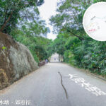
💧 【Tai Tam • Reservoir Road (大潭 • 水塘道)】 is a historic road in the Southern District of Hong Kong Island. Spanning about 5 km, it connects Wong Nai Chung Gap with Tai Tam Tuk Reservoir, serving as the main access route for the Tai Tam Reservoir group. Built between the late 19th and early 20th centuries to support the construction of the Tai Tam reservoirs, this road winds past four major reservoirs (Tai Tam Upper, Tai Tam Byewash, Tai Tam Intermediate, and Tai Tam Tuk), witnessing the early growth of Hong Kong’s public water supply system. With sections running right alongside the water, it offers beautiful scenic views and is officially protected as part of Hong Kong’s Declared Monuments. —
📌 Quick Facts
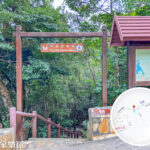
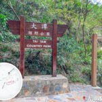
Item Details 🏞️ Name Tai Tam Reservoir Road 📍 Location Hong Kong Island, connecting Wan Chai District, Southern District, and Eastern District 📏 Distance Approx. 5.4 km (3.4 miles) 🚗 Speed Limit 50 km/h 🛣️ Lanes Two-way single track road 🏗️ Year Built Opened in phases from 1889 to 1917 🧭 Starting Point Wong Nai Chung Gap in Wan Chai District, near Wong Nai Chung Reservoir Park 🧭 Ending Point Near the Tai Tam Tuk Pumping Station in the Southern District 🚷 Vehicle Restrictions Closed to cars for the most part; only small sections at the north and south ends are drivable 🥾 Pedestrian Access Narrow footpaths available for hikers heading into the country park 🏞️ Jurisdiction Located within the boundaries of Tai Tam Country Park 🏛️ Heritage Value Home to 22 Declared Monuments and features a Waterworks Heritage Trail 🏕️ Facilities Along the Way Pavilions, benches, BBQ areas, a scout centre, and the Wong Nai Chung Gap war relics 🧭 Trail Connections Connects the end of Hong Kong Trail Section 4 with the start of Section 5 — Tai Tam Reservoir Road is more than just an infrastructure route—it is an awesome getaway that blends natural beauty with local history. Along the way, you can spot tons of heritage structures, like 19th-century stone bridges, massive dams, and waterworks equipment. The iconic stone bridges at Tai Tam Tuk Reservoir are especially famous and make for classic photo ops. The road is heavily shaded by trees and teeming with local wildlife—don’t be surprised if you run into monkeys, wild boars, or various birds, making it a hot spot for hikers, cyclists, and photographers. Since some sections get pretty narrow, cars need to watch out and stay safe, especially on weekends when the place gets packed with crowds. —
🏛️ Historical Background & Engineering
🏗️ Tai Tam Water Supply Scheme
- Construction Period: 1883–1917, taking 35 years to fully complete.
- Goal: To meet the booming fresh water demands of Hong Kong Island.
- The Challenge: Overcoming rugged terrain and engineering limits to cut through steep hills and rock layers.
💧 The Reservoirs
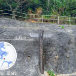
Reservoir Year Completed Highlights Tai Tam Upper Reservoir 1888 Built using granite and concrete; the dam was later raised to hold more water Tai Tam Byewash Reservoir 1904 The famous “Kwan Tai Lo” (Ar Chun’s Guide) stone marker is located nearby Tai Tam Intermediate Reservoir 1907 A crucial water source linked directly to the pumping station Tai Tam Tuk Reservoir 1917 Famous as the “First Dam of Asia” 💡 The Kwan Tai Lo Marker: Commemorates a local villager named Ah Queen who guided British forces through the hills to Victoria City, making it a legendary historical landmark. — For transport, you can enter Tai Tam Reservoir Road either from Wong Nai Chung Gap or the Tai Tam Tuk end, with several bus routes (like Citybus 6 and 63) connecting you back to town. In recent years, the government has carried out multiple maintenance and upgrade projects to preserve these historic sites and protect the natural environment, ensuring the trail stays pristine for the long run. It is not just a reminder of Hong Kong’s waterworks history, but a brilliant cultural playground where locals can connect with nature. —
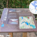
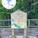
🏞️ Tai Tam Waterworks Heritage Trail
- Distance: Around 5 km, taking about 2 hours to complete.
- What to see: 21 Declared Monuments, including:
Structure Year Completed Highlights Tai Tam Tuk Raw Water Pumping Station 1905 Classic red-brick building with Chinese tiled roof; used to house steam-driven pumps Stone Bridges c. 1907 Granite arched structures connecting reservoirs and catchwaters Tai Tam Tuk Reservoir Dam 1912–1917 Features 12 spillways with granite arches supporting the road above - Highlights: Some of these facilities are actually still working today, serving as living proof of a century-old water supply history.
—
🎬 Pop Culture & Movie Spots
- “Cold War 2”: The pumping station was featured as a key filming location in this hit Hong Kong movie.
- Jaffe Road: Located in Wan Chai, this street is named after Chief Engineer Daniel Jaffe, who designed and oversaw the construction of the Tai Tam Tuk Reservoir Dam.
—
📸 Recommended Photo Spots
Location Why You Should Go Tai Tam Tuk Dam Stunning views of the massive dam; looks epic when water overflows during the rainy season The First Stone Bridge The ultimate angle for photos, located right near the public transport entrance Red Brick Pumping Station Beautifully preserved historic architecture with an awesome vintage vibe Upper Reservoir Dam Massive granite structures that showcase incredible engineering aesthetics —
🚶♀️ Hiking & Transport Advice
🚶♂️ Suggested Hiking Route
- Start at Wong Nai Chung Gap → Walk along Tai Tam Reservoir Road → Follow the Waterworks Heritage Trail → Finish at the Tai Tam Tuk Pumping Station
- Can easily extend your hike onto Section 5 of the Hong Kong Trail
🚍 Getting There
- By Bus: Hop on Bus 14 (from Sai Wan Ho) and get off at the “Tai Tam Country Park” stop
- By Foot: You can walk in straight from Wong Nai Chung Gap, with plenty of signposts and info boards guiding the way
—
🌿 Nature & Conservation Value
- The area’s forests were badly damaged during World War II, but the AFCD has spent decades replanting and restoring the habitat.
- Today, it stands as a massive green lung for Hong Kong Island, serving as a sanctuary for countless bird and insect species.
—