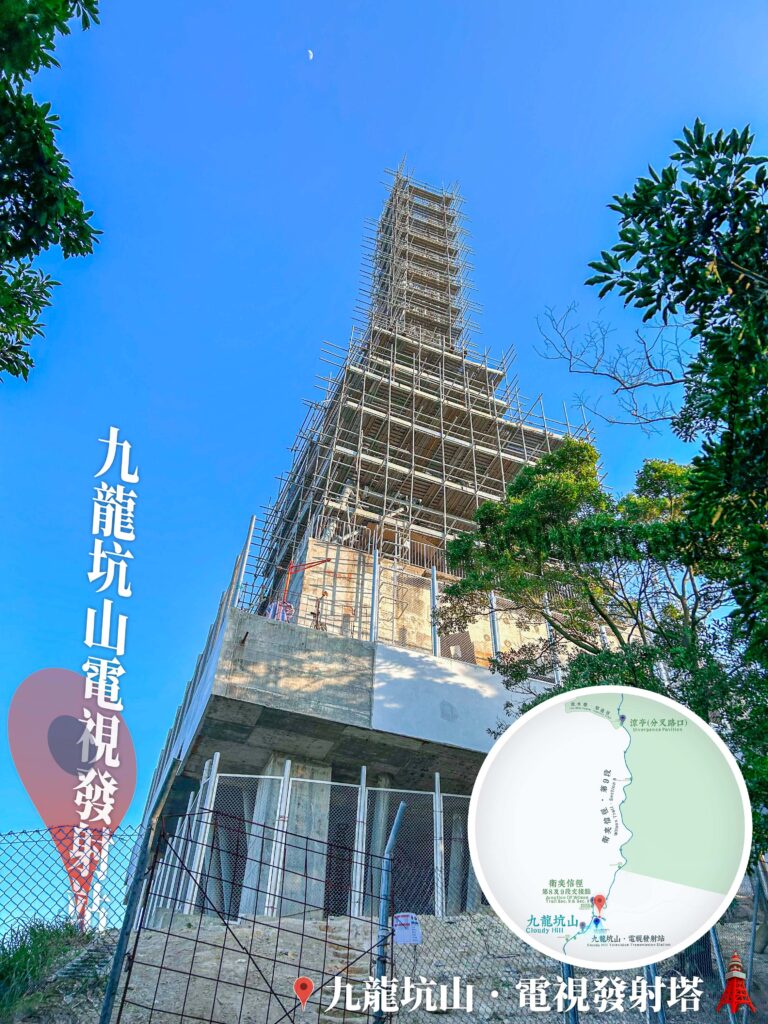
The history of the Cloudy Hill TV Transmission Tower is intimately tied to the development of telecommunications in Hong Kong. Located at the summit of Cloudy Hill in Tai Po District at an elevation of 440 metres, this transmission tower serves as one of Hong Kong’s primary transmitting stations for digital terrestrial television broadcasting. It services areas including Ma On Shan, Tai Po District, Fanling, and Sheung Shui, playing a vital role in television signal transmission for these regions.
📷 相片參數
Camera:
Lenses:
Keywords:
Subjects:
Location:
District:
Area:
香港地點:
麥景陶碉堡(礦山)
Po Lin Monastery
Robin's Nest Viewpoint
Kau Ling Chung View Compass
深涌農莊
Kwun Mun Sea Cave
Ma On Shan Mining Heritage Centre
Lung Ha Wan Stony Beach
Sham Chung Grassland
Mui Wo Ferry Pier
MacIntosh Fort Kong Shan
昂坪營地 (鳳凰山)
士美菲路街市及熟食中心
九龍坳風雨亭
春風亭
蓮麻坑鉛礦洞
石天窗
官門遺洞
美督明珠
Fat Jong Temple
嘉瑜園
Wu Tip Shan Tai Chi Garden
狗嶺涌觀景台
養心書院
Po Lin Monastery
Robin's Nest Viewpoint
Kau Ling Chung View Compass
深涌農莊
Kwun Mun Sea Cave
Ma On Shan Mining Heritage Centre
Lung Ha Wan Stony Beach
Sham Chung Grassland
Mui Wo Ferry Pier
MacIntosh Fort Kong Shan
昂坪營地 (鳳凰山)
士美菲路街市及熟食中心
九龍坳風雨亭
春風亭
蓮麻坑鉛礦洞
石天窗
官門遺洞
美督明珠
Fat Jong Temple
嘉瑜園
Wu Tip Shan Tai Chi Garden
狗嶺涌觀景台
養心書院
香港地方:
麥理浩徑第2段
曹舅峰
士美菲路
南大嶼郊遊徑
汀角路
Pat Sin Leng Country Park
Harlech Road
High Island Geo Trail
Yuk Sau Fung
鹿頸
Hong Kong Trail – Section 8
Kwu Tung South Road
中區自然徑
MacLehose Trail – Section 2
Sam A Tsuen
Pak Sha O
玉秀峰
MacLehose Trail – Section 4
Mui Wo Town Centre
山咀
Yim Tin Pok
Peak Road
屏風山
Kuai Li Fung
曹舅峰
士美菲路
南大嶼郊遊徑
汀角路
Pat Sin Leng Country Park
Harlech Road
High Island Geo Trail
Yuk Sau Fung
鹿頸
Hong Kong Trail – Section 8
Kwu Tung South Road
中區自然徑
MacLehose Trail – Section 2
Sam A Tsuen
Pak Sha O
玉秀峰
MacLehose Trail – Section 4
Mui Wo Town Centre
山咀
Yim Tin Pok
Peak Road
屏風山
Kuai Li Fung