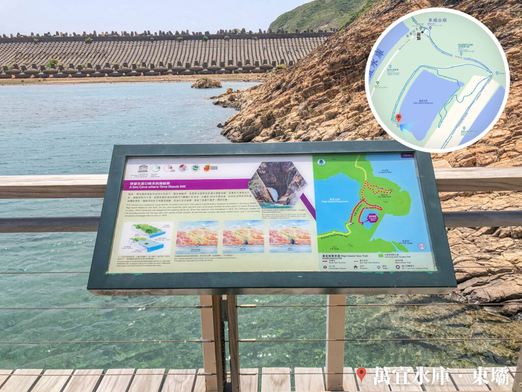
This is a natural cave formed by wave erosion called a 《Sea Cave》, which is a common coastal erosional landform in the Sai Kung area. Before the completion of High Island Reservoir, the sea cave faced the open sea, continuously expanding and deepening through long-term marine erosion. After the reservoir was completed in 1978, the breakwater effectively blocked the crashing waves from the coast. As a result, the sea cave stopped eroding and its evolution slowed down, leaving it preserved in almost the exact same form as it was back then.
📷 相片參數
Camera:
Lenses:
Subjects:
Location:
Place:
District:
Area:
- 📍 經緯度: ,
- |
- ⛰️ 高度:
香港地點:
Mui Wo Ferry Pier
Tung Shan Fat Mun
MTR Tai Po Market Station
西貢碼頭
陽元石
Pak Lap Store
芝加哥大學香港校園
二澳碼頭
The University of Chicago Francis and Rose Yuen Campus in Hong Kong
小西灣海濱花園
春風亭
Temple Mall North
Greenery Garden
Coombe Road Children’s Playground
官門遺洞
Biu Tsim Kok Viewing Platform
Smithfield Market and Cooked Food Centre
港鐵大埔墟站
Ngong Ping Campsite (Lantau Peak)
Ngong Ping Piazza
鴨脷排連島沙洲
Old Victoria Hospital Maternity Block
盧吉飛瀑
湛山寺
Tung Shan Fat Mun
MTR Tai Po Market Station
西貢碼頭
陽元石
Pak Lap Store
芝加哥大學香港校園
二澳碼頭
The University of Chicago Francis and Rose Yuen Campus in Hong Kong
小西灣海濱花園
春風亭
Temple Mall North
Greenery Garden
Coombe Road Children’s Playground
官門遺洞
Biu Tsim Kok Viewing Platform
Smithfield Market and Cooked Food Centre
港鐵大埔墟站
Ngong Ping Campsite (Lantau Peak)
Ngong Ping Piazza
鴨脷排連島沙洲
Old Victoria Hospital Maternity Block
盧吉飛瀑
湛山寺
香港地方: