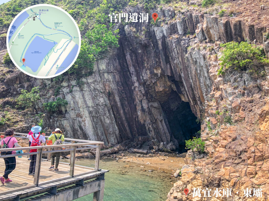
This is a natural cave formed by wave erosion called a 《Sea Cave》, which is a common coastal erosional landform in the Sai Kung area. Before the completion of High Island Reservoir, the sea cave faced the open sea, continuously expanding and deepening through long-term marine erosion. After the reservoir was completed in 1978, the breakwater effectively blocked the crashing waves from the coast. As a result, the sea cave stopped eroding and its evolution slowed down, leaving it preserved in almost the exact same form as it was back then.
📷 相片參數
Camera:
Lenses:
Subjects:
Location:
Place:
District:
Area:
- 📍 經緯度: ,
- |
- ⛰️ 高度:
香港地點:
亞公角瞭望所
Lung Ha Wan Kite Flying Area
Ap Lei Pai Tombolo
西貢碼頭
Tai Long Wan Campsite
東壩涼亭
蓮麻坑鉛礦洞
大埔墟專線小巴總站
Kwun Mun Sea Cave
深涌農莊
Wisdom Path
松林炮台
Wu Tip Shan Tai Chi Garden
大埔墟巴士總站
Fan Lau Fort
水浪窩觀星台
舊域多利醫院產科大樓
天梯石
Clearwater Bay Equestrian and Education Centre
小鳥回頭
Fat Jong Temple
Greenery Garden
長排頭天池
The Peak Galleria
香港地方:


