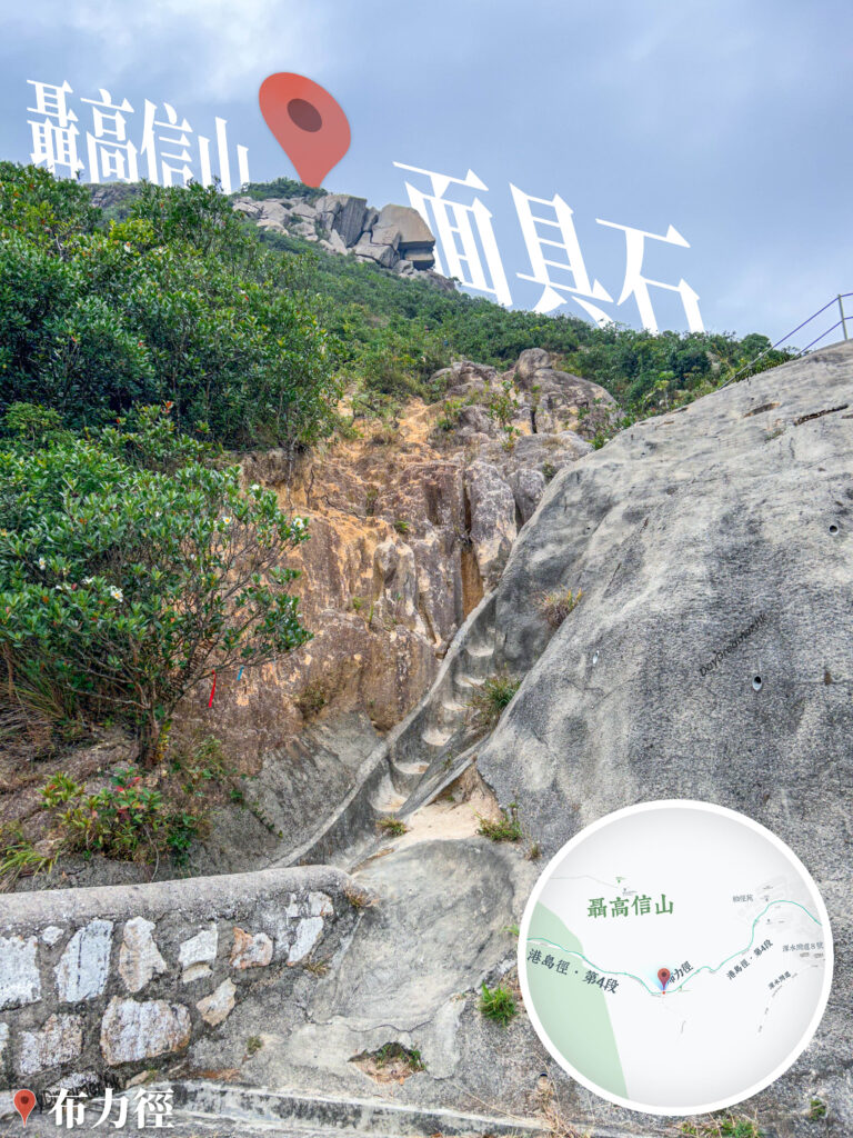
Continuing our 『Cross the Frog 🐸 Journey』 from The Peak Galleria and passing through Findlay Path, the Central Green Trail, Barker Road, and Coombe Road, we walked 5.5 kilometres to arrive at Black’s Link. Black’s Link is a road located in the southern part of Hong Kong Island connecting Wan Chai Gap and Wong Nai Chung Gap, named after Major-General Wilsone Black, the Commander of British Forces in Hong Kong during the late 19th century. A portion of Black’s Link constitutes the route for Hong Kong Trail Section 4, offering beautiful scenic landscapes throughout the journey making it highly suitable for hiking and walking. The Mask Rock 🪨 is an extraordinarily shaped boulder located on the Southern Slope of Mount Nicholson ⛰ in central Hong Kong Island, resembling a human face complete with eyes, a nose, and a mouth. Standing about 10 metres high and composed of granite, the Mask Rock 🪨 is a naturally formed geological phenomenon. Running alongside the rock is a narrow fissure known as the Yat Sin Tianshi / Fissure Rock Chamber; passing through this crevice allows hikers to reach the side of the Mask Rock to take in the beautiful coastal scenery of Repulse Bay. The Mask Rock 🪨 is a famous photo-taking hotspot on Mount Nicholson ⛰, drawing numerous hiking enthusiasts and photographers to explore and capture its likeness.