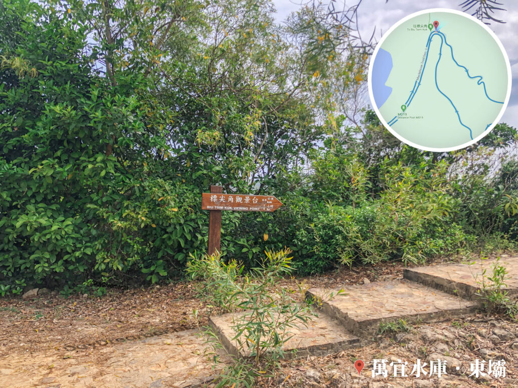
看見路牌所示,前往【標尖角觀景台】還有約500米,需時約15分鐘。這張照片展示了香港聯合國教科文組織世界地質公園內,萬宜水庫東壩前往標尖角步道的路口場景。畫面中央立有一根深褐色木製郊遊指示牌,箭頭形木牌指向右側,上方寫有白色的中英文「標尖角觀景台 / BIU TSIM KOK VIEWING POINT」,並清楚註明「0.5 公里」及「1/4 小時」。指示牌後方是一片茂密蒼翠的綠色樹林與灌木叢,地面佈滿枯葉;右前方則是由黃褐色石磚鋪設而成的幾級行山階梯緩步上升。
📷 相片參數
Camera:
Lenses:
Subjects:
Location:
District:
Area:
香港地點:
Biu Tsim Kok Viewing Platform
蓮麻坑鉛礦洞
鞍山探索館
嘉道理農場
蝴蝶山太極園
春風亭
The Peak Galleria
A Kung Kok Lookout
Mount Johnston Lighthouse
Fat Jong Temple
白腊士多
Ap Lei Pai Tombolo
來記士多
Mui Wo Ferry Pier
Greenery Garden
法藏寺
昂坪營地 (鳳凰山)
三椏涌營地
Shui Long Wo Star Lookout
山頂廣場
The University of Chicago Francis and Rose Yuen Campus in Hong Kong
Tung Shan Fat Mun
分流石筍
Kadoorie Farm and Botanic Garden
蓮麻坑鉛礦洞
鞍山探索館
嘉道理農場
蝴蝶山太極園
春風亭
The Peak Galleria
A Kung Kok Lookout
Mount Johnston Lighthouse
Fat Jong Temple
白腊士多
Ap Lei Pai Tombolo
來記士多
Mui Wo Ferry Pier
Greenery Garden
法藏寺
昂坪營地 (鳳凰山)
三椏涌營地
Shui Long Wo Star Lookout
山頂廣場
The University of Chicago Francis and Rose Yuen Campus in Hong Kong
Tung Shan Fat Mun
分流石筍
Kadoorie Farm and Botanic Garden
香港地方:
谷埔
逢吉鄉
Lion's Tail Ridge Path
Tsin Yue Wan
白沙澳
Lion Rock
Fan Lau Sai Wan
Wu Kau Tang Road
MacLehose Trail – Section 2
麥理浩徑第6段
Choi Wo Fung
大深涌
湘子峰
Mount Johnston / Yuk Kwai Shan
水浪窩
Pak Tai To Yan
鎖羅盆
MacLehose Trail – Section 6
Lung Fu Shan Country Park
塘肚
八仙嶺郊野公園
Hong Kong Trail – Section 8
Pak Sha O
Roaring Tiger Rock River
逢吉鄉
Lion's Tail Ridge Path
Tsin Yue Wan
白沙澳
Lion Rock
Fan Lau Sai Wan
Wu Kau Tang Road
MacLehose Trail – Section 2
麥理浩徑第6段
Choi Wo Fung
大深涌
湘子峰
Mount Johnston / Yuk Kwai Shan
水浪窩
Pak Tai To Yan
鎖羅盆
MacLehose Trail – Section 6
Lung Fu Shan Country Park
塘肚
八仙嶺郊野公園
Hong Kong Trail – Section 8
Pak Sha O
Roaring Tiger Rock River